
 Malibu · APN 4469-045-002 · 1.65 acres
Vacant land · City of Malibu · Pacific view
30720 Morning View DriveMalibu, California 90265
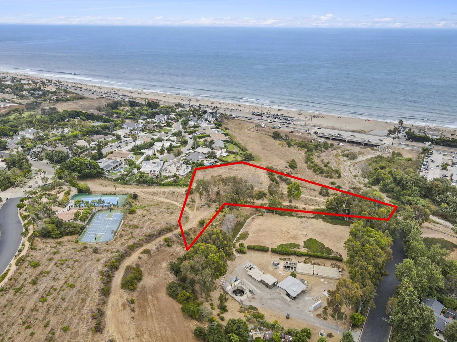
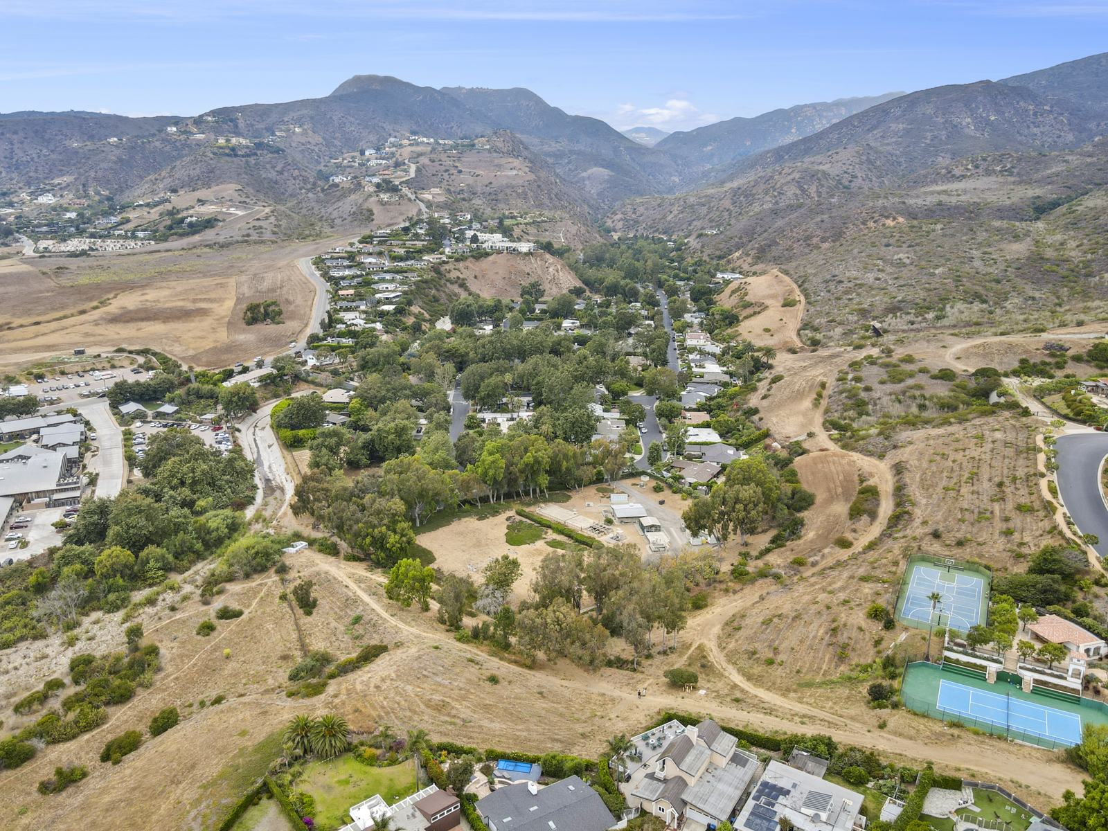
An acre and two-thirds of open hillside above Zuma Beach, with the Pacific filling the view to the south and the Santa Monica Mountains rising behind. Held in fee simple, with no loans of record, and with road access granted in the deed itself.
Offered at$3,900,000
- 1.65 acres±71,700 SF · Assessor
- Pacificand mountain views
- City of Malibubetween Zuma and Trancas
- Geologysite feasible · 2017 evaluation
- Free & clearno loans of record
- Deeded accessover private tract streets
What the record shows
Read the title report the way a buyer’s attorney will.
Everything below comes from the preliminary title report issued by Consumer’s Title as agent for First American, effective June 26, 2025, and the plat that accompanies it. Both are in the file. Where something is our reading rather than the document’s words, it says so.
- The land
A metes-and-bounds parcel carved from the old Rancho Topanga Malibu Sequit — the land patented to Matthew Keller — bounded on one side by Tract 26955 and on another by land deeded to Los Angeles County in 1962. Title is fee simple. The Assessor’s data puts it at 1.646 acres; there is no survey on file.
- The access
Parcel 2 of the legal description is an appurtenant easement for ingress and egress over the streets shown as private streets on the Tract 26955 map (Book 687, pages 8 to 11). It is written into the vesting deed, so it transfers with the land rather than depending on a neighbor’s goodwill.
- The easements on it
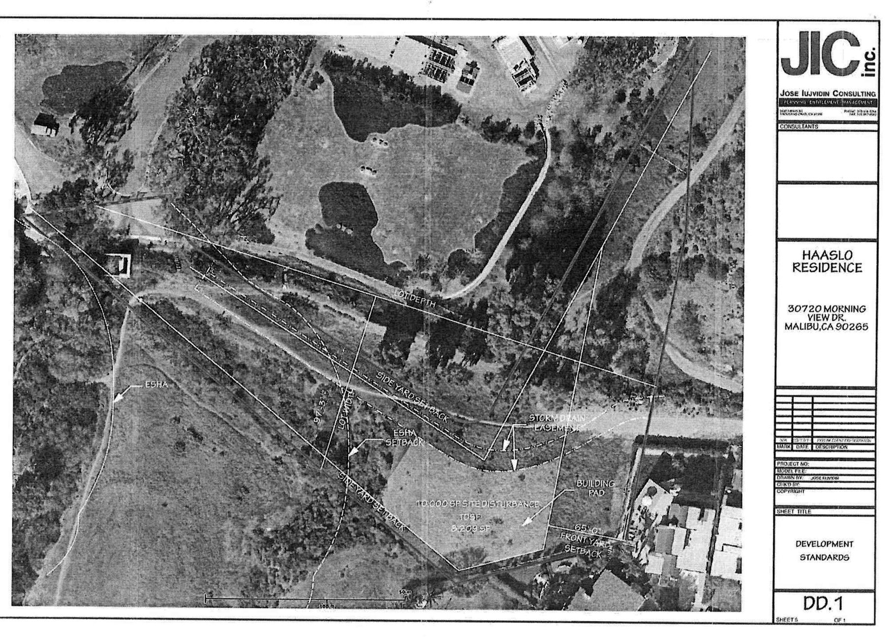
Three are recorded against the parcel: Southern California Edison for public utilities, which the title company describes as unlocatable; a 1990 storm-drain easement; and a 2009 easement to Los Angeles County Waterworks District No. 29 for water pipelines with ingress and egress. The plat locates the last two.
- Consent to use
Notices of Consent to Use of Land under Civil Code §813 were recorded in 1979 and again in 2018. The 2018 notice, in the file, lets students, teachers and parents of Juan Cabrillo Elementary and Malibu High cross the land on foot or by bicycle in daylight, and says the permission is revocable at any time. That is the footpath you see in the aerials. A recorded §813 notice keeps that use permissive, so it cannot ripen into a public easement. The 1979 notice is not yet in the file, and the title report still carries its standard exception for public rights, so confirm the point with your own counsel.
- Money against it
The title company’s examination “does not disclose any existing loans.” No conveyances have been recorded in the twenty-four months before the report. Minerals and hydrocarbons are reserved under older deeds, as is common across Malibu.
- Insurability
The report says nothing in it would cause the company to decline a CLTA 116 endorsement identifying the land as vacant, or a CLTA 100 endorsement on an extended-coverage loan policy.
The ground
A geologist has already walked it, and found a building site.
In March 2017 Gold Coast GeoServices, a Camarillo firm of engineering geologists, evaluated the parcel for the current owner’s purchase. It was a records review and a site reconnaissance, not a drilled investigation. These are its findings, in its own terms.
- What it stands on
An ancient river terrace laid down about 100,000 years ago at the mouth of Trancas Canyon, with sand, silt, clay and gravel estimated at 30 to 70 feet thick over older marine rock. The geologist calls these terrace deposits favorable for slope stability, with no daylighted bedding or other adverse structure known on or next to the site.
- The lie of the land
Gently sloping, with less than fifty feet of relief across the whole parcel and slopes generally gentler than 3:1. The proposed building site, on the southeast side, sits outside the drainage courses, the storm drain easement and any area of concentrated flow.
- Hazards
No landslides on published maps or in the field. Outside the state’s fault-rupture, liquefaction and earthquake-induced landslide zones. The mapped trace of the Malibu Coast fault is about 1,000 feet north, more than the 500 feet at which the City requires a fault investigation. The report flags possible tsunami exposure on the western edge of the parcel, which it did not analyze.
- The conclusion
“The proposed building site is considered to be feasible from a geotechnical standpoint, pending findings from a more detailed geotechnical investigation.” The firm estimated that investigation, a combined geology and soils report with borings, at about $25,000 in 2017.
- Wastewater
There is no sewer, so the house needs an onsite treatment system with nitrate pretreatment. The report says the terrace deposits in this part of Malibu are known to absorb wastewater well. Seasonal groundwater could rise after storms, so a hydrogeologic study is needed to set the system’s required ten-foot separation.
- How to read it
The report is from 2017, and its engagement terms limit reliance to the client who commissioned it. It is posted so you can see what is known about the ground, not as something to rely on. Your own geotechnical engineer should repeat the work with borings.
The file
Every document, organized the way a buyer reads it.
These are the documents in hand. Each one says, in plain language, why it matters. If it is listed here, we have read it. If we have not got it yet, it is under “What is not settled” below.
Title and recordWhat the County Recorder and the title company say about the land.3
Geology and site planningAn engineering geologist’s evaluation, with the planner’s site study attached.1
Aerial photographyFourteen drone frames with the parcel outlined, plus a location map.15
FilmThe property from the air, in motion.1
Site photographsTaken on the ground by the listing agent.3
23 files on file · updated October 5, 2026
Open the whole data roomEvery file in one folder. View any of them, or download the lot.Open the folder →Straight answers
What is not settled yet.
This is raw land in Malibu, and some of the questions that matter are ones no document in the file answers yet. Here they are, before you ask.
- What you can build
The 2017 planner’s study suggests a pad of about 10,000 square feet of disturbance and roughly 8,200 square feet of total development, set back from an ESHA boundary along the canyon. That was a preliminary presentation, made before plans existed. The City of Malibu has not confirmed the zoning or the habitat boundary, and nothing has been submitted. The title profile prints a County zoning code that does not govern land inside the City.
- Geotechnical work
The 2017 evaluation was a reconnaissance. The City will require a full engineering geology and soils report with borings, and a hydrogeologic study for the wastewater system.
- Water
A Waterworks District No. 29 easement crosses the parcel and there is a hydrant nearby, but no will-serve letter is on file.
- The road in
The geologist reached the site by an unimproved road at the west end of Morning View Drive, at Seastar Drive. The deed grants rights over the private streets of Tract 26955. Who maintains the road, and what the Fire Department will require of it, are not documented.
- The recorded instruments
The 2018 consent notice is in the file. The 1979 notice and the three easement deeds are listed in the title report but not attached. We are requesting them from title and will post them here.
- An older title report
The report is effective June 26, 2025. An updated report will be ordered before or at the opening of escrow.
- Boundaries
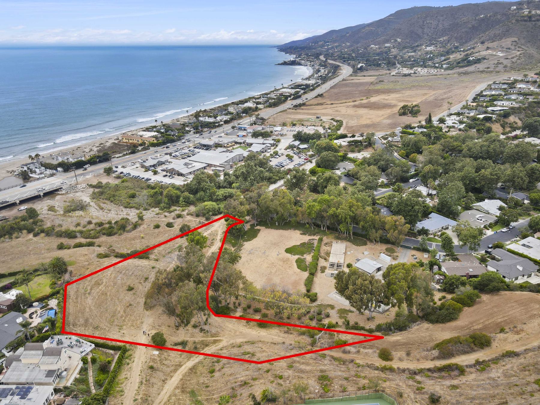
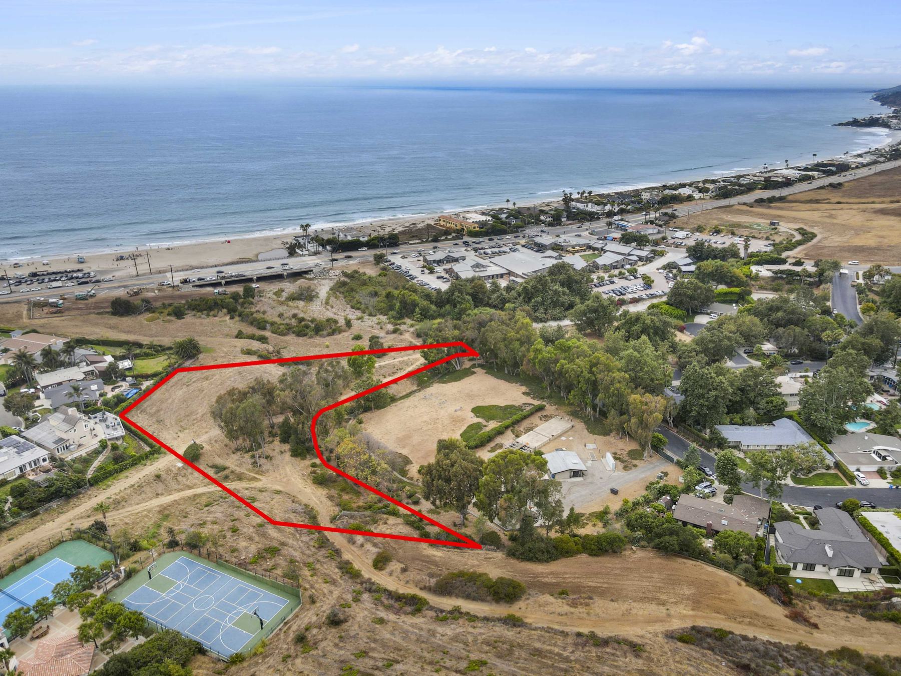
The outlines on the aerials are drawn from record data to show roughly where the land lies. They are not a survey. Acreage is the Assessor’s figure (1.646 acres); the geologist estimated about 1.67.
Location
Above Zuma, below the mountains, minutes from Trancas.
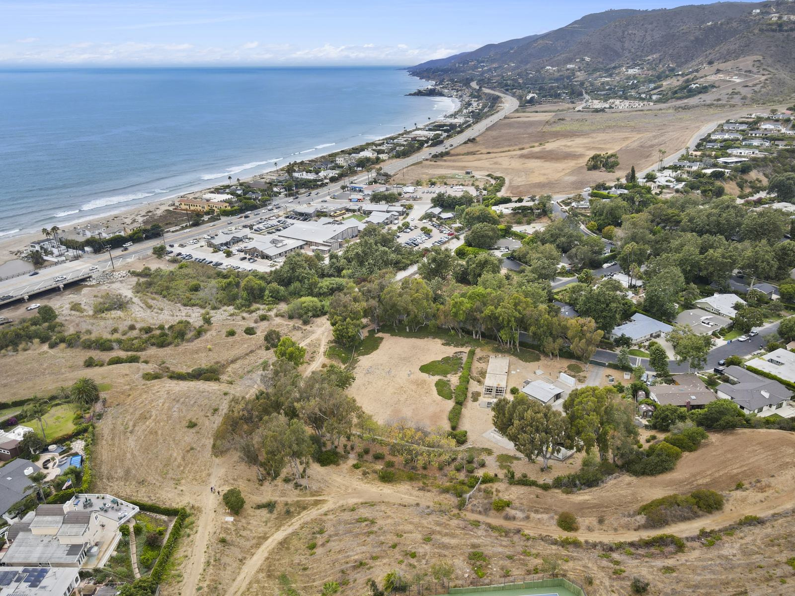
The parcel sits on the rise behind Pacific Coast Highway in western Malibu, between Zuma Beach and Trancas Canyon, with the Trancas Country Market a short drive away. Below it there is the beach, and behind it the open slopes of the Santa Monica Mountains.
The land
An acre and two-thirds, photographed from the air.
There is no house to show yet. What there is: the hillside, the ocean it faces and the mountains behind it.
All 14 aerials — select any image to view it full size